 Quality control of reinforced concrete structures is one of the most labour-intensive stages of infrastructure construction. Inspecting reinforcement cages traditionally involves on-site measurements, photographic documentation, processing large volumes of data and preparing as-built documentation.
For large-scale construction projects, this represents a significant time investment for engineering teams. Digitalising these operations therefore has not only technological but also direct operational value: the faster field data is converted into structured information, the fewer resources are required for quality control.
From manual photographic documentation to 3D inspection
A practical example of this approach was demonstrated by Pix4D, a Swiss software developer specialising in mapping, photogrammetry and 3D analysis.
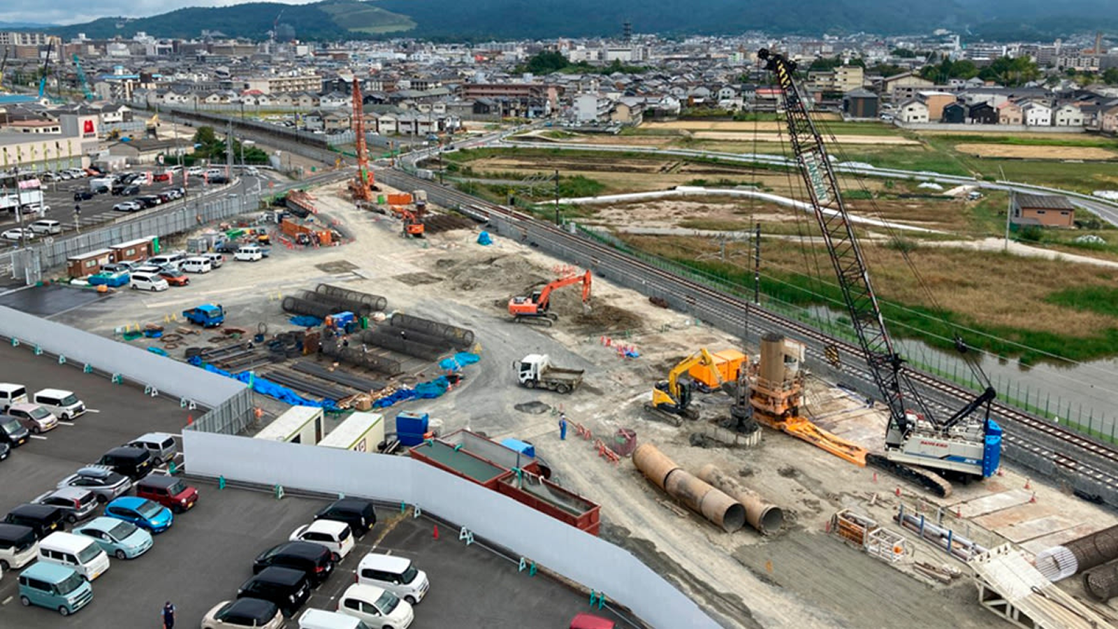
As part of the modernisation project for the Kansai Main Line, the railway line connecting Osaka and Nagoya, Pix4Dcatch was used for the digital inspection of reinforcement cages in conjunction with Modely, a platform specialising in 3D reinforcement inspection.
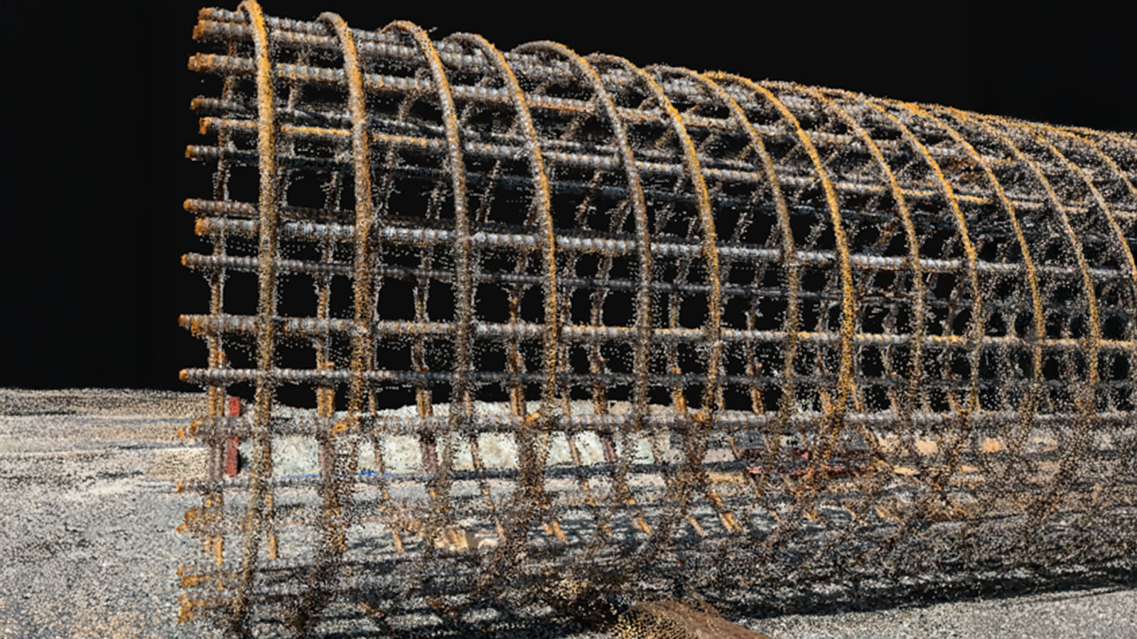
Instead of relying on traditional photographic documentation and manual measurements, the workflow was digitised using 3D point clouds. This reduced the number of field operations and enabled a faster transition from data collection to analysis.
The challenge: 3D data accuracy on the construction site
One of the challenges encountered when testing mobile 3D solutions was the accurate capture of fine reinforcement elements. Some systems produced gaps in point clouds, inaccurate representations of reinforcement bars and results that depended heavily on the operator.
Pix4Dcatch combines photogrammetry and LiDAR to generate detailed 3D data and capture fine reinforcement elements.
Another important advantage is the ability to carry out surveys without ground control points (GCPs). This is particularly relevant on active construction sites, where installing and maintaining control markers can add operational costs and complicate the workflow.
The operator simply needs to walk around the structure with a smartphone to capture the data required to generate the 3D model.
How the digital process works
The workflow used in the project consisted of four main stages:
- Scanning. The operator scanned the reinforcement cage using Pix4Dcatch on an iPhone Pro.
- Processing. The collected data was processed into a 3D point cloud in PIX4Dcloud.
- Model preparation. Redundant data and noise were removed from the point cloud for further analysis.
- Inspection. The prepared model was transferred to Modely, where automated reinforcement recognition, geometry checks and report generation were performed.
This workflow reduces manual operations and creates a digital process that connects field scanning with structural inspection.

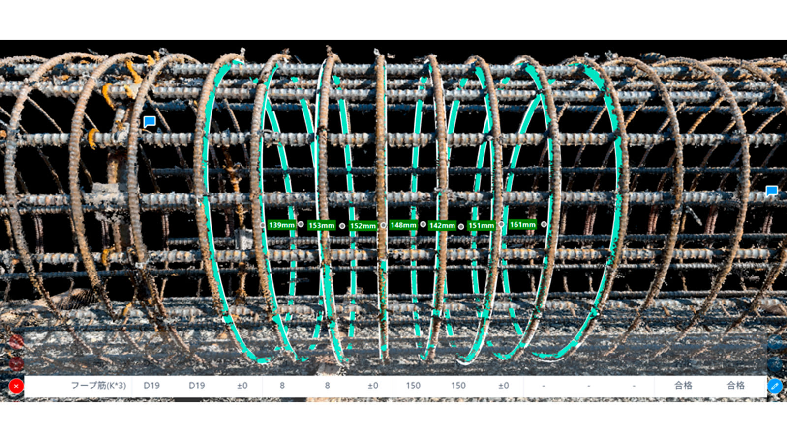
56% reduction in inspection time
The digital workflow was used to inspect 129 reinforcement cages for bored piles, which formed the foundations of a railway viaduct.
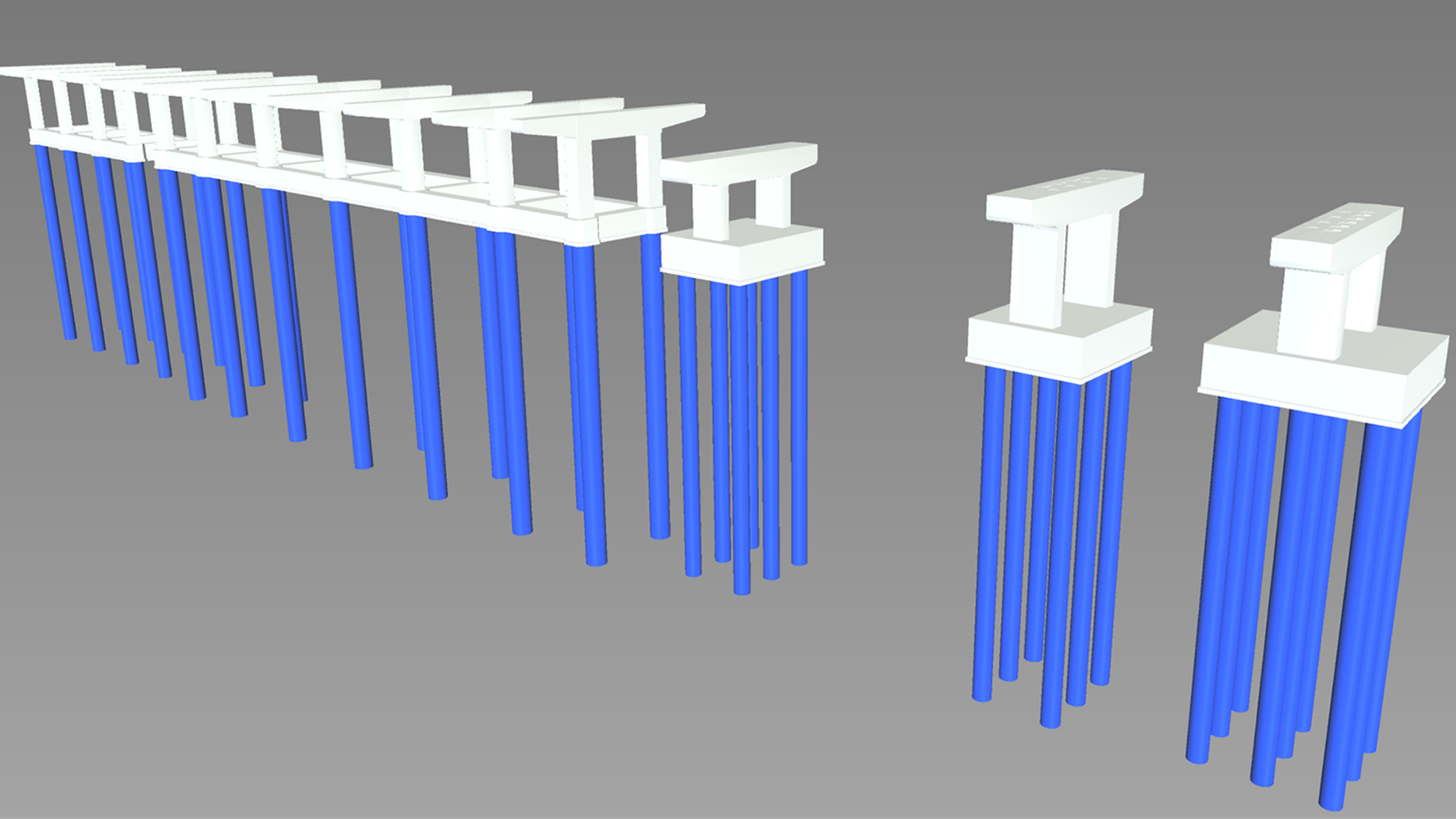
One of the key performance indicators was the reduction in the number of photographs required to inspect each reinforcement cage:
- before implementation — 81 photos per cage;
- after implementation — 39 photos per cage;
- total number of photos — reduced from 10,449 to 5,031.
As a result, the time required to inspect a single reinforcement cage was reduced by 56 per cent, while the total saving in working time amounted to approximately 850 hours, or 106 person-days.
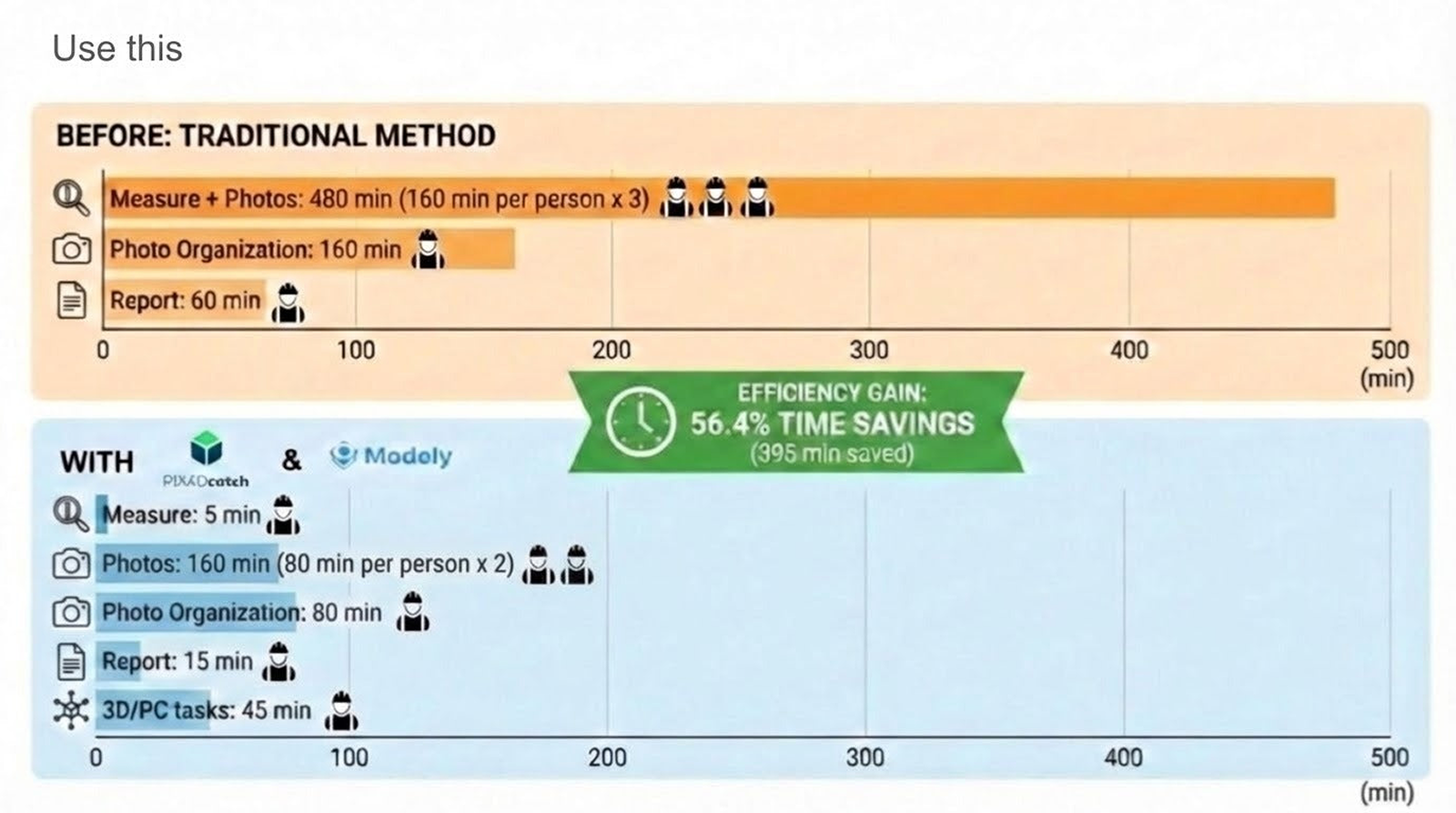
The time savings were not limited to faster field data collection. The digital workflow also reduced the amount of manual work involved in processing photographs, taking measurements, sorting data and preparing reports.
What this means for construction companies
This case study demonstrates that mobile 3D surveying can be more than a data collection tool — it can form part of a digital quality control workflow for construction projects.
For infrastructure and construction companies, this approach can provide:
- reduced time spent on field inspections;
- fewer manual operations;
- a more standardised data collection process;
- greater consistency and repeatability of results;
- a faster transition from field data to analysis and reporting;
- the ability to scale the workflow across standardised structures and repetitive operations.
This approach is particularly relevant to structures with standardised reinforcement layouts, such as bored piles, where repeatable processes create favourable conditions for systematic digital inspection.
Pix4D in the Robotics Distribution portfolio
Pix4D is part of the product portfolio of Robotics Distribution — one of Ukraine’s top 10 IT distributors and a member of the DroneUA group of companies.
Robotics Distribution develops Pix4D’s range of professional solutions for mapping, photogrammetry, 3D documentation and digital inspection. For us, it is important not simply to provide access to software, but to help partners and end users determine how these tools can be integrated into specific workflows.
Robotics Distribution is expanding its partner network and opening up opportunities for businesses interested in implementing and distributing cutting-edge technological solutions. If you work in construction, surveying, mapping, infrastructure projects or digital quality control, please contact the Robotics Distribution team to learn more about the available partnership options.
Fill in the partner form:
https://docs.google.com/forms/d/e/1FAIpQLSedx1T87kvREM1IKtaH7eNfKbtpJlxltc07WyzZNwZ5IjFujQ/viewform